A brief overview of Phuket’s history, culture and general information. Phuket is the biggest island in the Andaman Sea of southern Thailand. The island is mostly mountainous with a mountain range in the west of the island from the north to the south. The mountains of Phuket form the southern end of the Phuket mountain range, which ranges for 440 kilometres (270 mi) from the Kra Isthmus.
| Location | Andaman Sea |
| Coordinates | 7°53′24″N / 98°23′54″E |
| Area | 576 km2 (222 sq mi) |
| Length | 50 km (31 mi) |
| Width | 20 km (12 mi) |
| Highest elevation | 529 m (1,736 ft) |
| Highest point | Khao Mai Thao Sip Song |
| Population | 600,000 (as of 2013) |
| Density | 1,042 /km2 (2,699 /sq mi) |
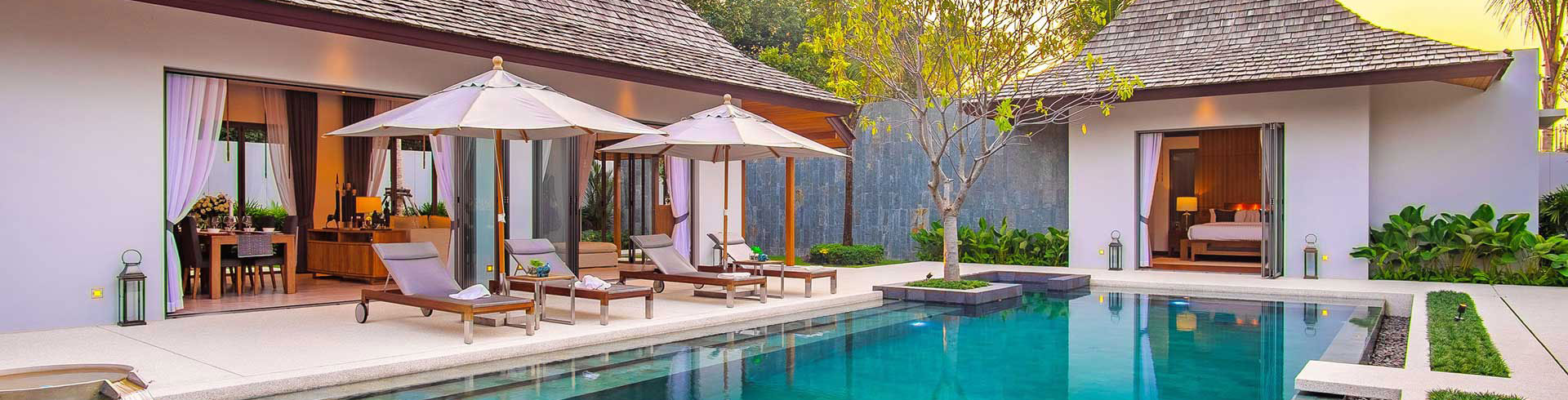
Living Or Retiring On Phuket
 Phuket offers an easygoing lifestyle, or a club-hopping, center-of-the-action one, depending on your preference. For instance, you can go for a swim and a relaxing lunch on quiet Naithon Beach or you can join the buzz in the bar-lined Patong area, where music throbs and cabaret shows continue into the night. And with Thailand’s second-busiest international airport, you can easily catch a flight to a range of destinations, without transiting through Bangkok.
But the biggest draw for many expats is the comfortable, convenient lifestyle. In Phuket you can enjoy some of the best seafood in the south of the country and dine at a range of gourmet restaurants, from sushi to Italian, to Indian. You’ll find grocery stores stocking imported foods, fashion and furniture boutiques, and golf courses galore. Expat clubs welcome newcomers and offer everything from cycling to sailing, and access to top-notch medical care is a reality here, at a fraction of the cost of back home.
Phuket is one of the southern provinces (changwat) of Thailand. It consists of the island of Phuket, the country’s largest island, and another 32 smaller islands off its coast. It lies off the west coast of Thailand in the Andaman Sea. Phuket Island is connected by bridge to Phang Nga Province to the north. The next nearest province is Krabi, to the east across Phang Nga Bay.
Phuket Province has an area of 576 square kilometres (222 sq mi), somewhat less than that of Singapore, and is the second-smallest province of Thailand. It formerly derived its wealth from tin and rubber, and enjoys a rich and colorful history. The island was on one of the major trading routes between India and China, and was frequently mentioned in foreign ship logs of Portuguese, French, Dutch, and English traders. The region now derives much of its income from tourism.
Although some recent geographical works refer to the sections of the Tenasserim Hills in the isthmus as the “Phuket Range”, these names are not found in classical geographic sources. In addition, the name Phuket is relatively recent having previously been named Jung Ceylon and Thalang. The highest elevation of the island is usually regarded as Khao Mai Thao Sip Song (Twelve Canes), at 529 metres (1,736 ft) above sea level. However it has been reported by barometric pressure readings that there is an even higher elevation (with no apparent name), of 542 meters above sea level, in the Kamala hills behind Kathu waterfall.
Its population was 249,446 in 2000, rising to 525,709 in the 2010 decennial census, the highest growth rate of all provinces nationwide at 7.4% annually. Some 600,000 people reside on Phuket currently, among them migrants, international expats, Thais registered in other provinces, and locals. The registered population, however, includes only Thais, and the end of 2012 was 360,905 persons.
Phuket is approximately 863 kilometres (536 mi) south of Bangkok, and covers an area of 543 square kilometres (210 sq mi) excluding small islets. It is estimated that Phuket would have a total area of approximately 576 square kilometres (222 sq mi) if all its outlying islands were included. Other islands are: Ko Lone 4.77 square kilometres (1.84 sq mi), Ko Maprao 3.7 square kilometres (1.4 sq mi), Ko Naka Yai 2.08 square kilometres (0.80 sq mi), Ko Racha Noi 3.06 square kilometres (1.18 sq mi), Ko Racha Yai 4.5 square kilometres (1.7 sq mi), and the second biggest, Ko Sire 8.8 square kilometres (3.4 sq mi).
The island’s length, from north to south, is 48 kilometres (30 mi) and its width is 21 kilometres (13 mi).
Seventy percent of Phuket’s area is covered with mountains which stretch from north to south. The remaining 30% are plains in the central and eastern parts of the island. It has a total of 9 brooks and creeks, but does not have any major rivers.
Forest, rubber, and palm oil plantations cover 60% of the island. The west coast has several sandy beaches. The east coast beaches are more often muddy. Near the southernmost point is Laem Promthep (“Brahma’s Cape”), a popular view point. In the mountainous north of the island is the Khao Phra Thaeo No-Hunting Area, protecting more than 20 km² of rainforest. The three highest peaks of this reserve are the Khao Prathiu (384 metres (1,260 ft)), Khao Bang Pae 388 metres (1,273 ft), and Khao Phara 422 metres (1,385 ft). The Sirinat National Park on the northwest coast was established in 1981 to protect an area of 90 square kilometres (35 sq mi) (68 kilometres (42 mi) marine area), including the Nai Yang Beach where sea turtles lay their eggs.
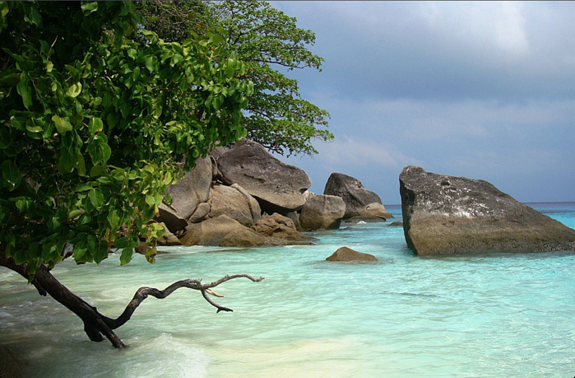
The most popular (and overcrowded) tourist area on Phuket is Patong Beach on the central west coast, perhaps owing to the easy access to its wide and long beach. Most of Phuket’s nightlife and its shopping is in Patong, and the area has become increasingly developed. Patong means “the forest filled with banana leaves” in Thai. South of Patong lie Karon Beach, Kata Beach, Kata Noi Beach, and around the southern tip of the island, Nai Harn Beach and Rawai. To the north of Patong are Kamala Beach, Surin Beach, and Bang Tao Beach. These areas are generally much less developed than Patong. To the southeast is Bon Island and to the south are several coral islands. The Similan Islands lie to the northwest, and the Phi Phi Islands to the southeast.
In the 17th century, the Dutch, English and, after the 1680s, the French, competed for the opportunity to trade with the island of Phuket (then known as “Jung Ceylon”), which was a rich source of tin. In September 1680, a ship of the French East India Company visited Phuket and left with a full cargo of tin.
A year or two later, the Siamese King Narai, seeking to reduce Dutch and English influence, named as governor of Phuket a French medical missionary, Brother René Charbonneau, a member of the Siam mission of the Société des Missions Etrangères. Charbonneau remained as governor until 1685.
In 1685, King Narai confirmed the French tin monopoly in Phuket to their ambassador, the Chevalier de Chaumont. Chaumont’s former maître d’hôtel, Sieur de Billy, was named governor of the island. However, the French were expelled from Siam after the 1688 Siamese revolution. On 10 April 1689, Desfarges led an expedition to re-capture Phuket to restore French control in Siam. His occupation of the island led to nothing, and Desfarges returned to Puducherry in January 1690.
The Burmese attacked Phuket in 1785. Francis Light, a British East India Company captain passing by the island, notified the local administration that he had observed Burmese forces preparing to attack. Than Phu Ying Chan, the wife of the recently deceased governor, and her sister Mook (คุณมุก) assembled what local forces they could. After a month-long siege of the capital city, the Burmese were forced to retreat on 13 March 1785. The women became local heroines, receiving the royal titles Thao Thep Kasattri and Thao Si Sunthon from a grateful King Rama I. During the reign of King Chulalongkorn (Rama V), Phuket became the administrative center of the tin-producing southern provinces. In 1933 Monthon Phuket (มณฑลภูเก็ต) was dissolved and Phuket became a province.
| Climate data for Phuket | |||||||||||||
|---|---|---|---|---|---|---|---|---|---|---|---|---|---|
| Month | Jan | Feb | Mar | Apr | May | Jun | Jul | Aug | Sep | Oct | Nov | Dec | Year |
| Average high °C (°F) | 32.7 (90.9) |
33.6 (92.5) |
34.0 (93.2) |
33.9 (93) |
32.8 (91) |
32.4 (90.3) |
32.0 (89.6) |
32.0 (89.6) |
31.5 (88.7) |
31.5 (88.7) |
31.7 (89.1) |
31.7 (89.1) |
32.48 (90.48) |
| Average low °C (°F) | 24.5 (76.1) |
24.9 (76.8) |
25.4 (77.7) |
25.8 (78.4) |
25.6 (78.1) |
25.5 (77.9) |
25.1 (77.2) |
25.3 (77.5) |
24.6 (76.3) |
24.5 (76.1) |
24.7 (76.5) |
24.4 (75.9) |
25.02 (77.04) |
| Average rainfall mm (inches) | 30.3 (1.193) |
23.9 (0.941) |
73.5 (2.894) |
142.9 (5.626) |
259.5 (10.217) |
213.3 (8.398) |
258.2 (10.165) |
286.8 (11.291) |
361.2 (14.22) |
320.1 (12.602) |
177.4 (6.984) |
72.4 (2.85) |
2,219.5 (87.381) |
| Average rainy days (≥ 1 mm) |
4 | 3 | 5 | 11 | 21 | 19 | 19 | 19 | 23 | 22 | 16 | 8 | 170 |
| Average relative humidity (%) | 70 | 69 | 71 | 75 | 79 | 79 | 79 | 79 | 82 | 82 | 79 | 75 | 76.6 |
| Mean monthly sunshine hours | 286.2 | 271.5 | 282.3 | 247.9 | 188.5 | 139.5 | 172.6 | 174.1 | 143.2 | 179.8 | 197.1 | 244.3 | 2,527 |
Two Heroines Monument (อนุสาวรีย์วีรสตรี), is a monument in Amphoe Thalang, a memorial statue of the heroines Thao Thep Kasattri (Kunying Jan) and Thao Sri Sunthon (Mook), who rallied islanders in 1785 to repel Burmese invaders. As the island’s governor had just died, the organization of Phuket’s defense against the Burmese invasion of 1785 was conducted by his widow, Thao Thep Kasattri. With her sister’s help, they assembled what forces they had, then disguised local women as male soldiers, a ruse to swell the ranks of the defenders. After a month’s siege, the Burmese invaders became exhausted and withdrew. King Rama I awarded Kunying Jan with the royal title of Thao Thep Kasattri.
Thalang National Museum (พิพิธภัณฑสถานแห่งชาติ ถลาง) is near the Two Heroines Monument. In 1985, on the 200th anniversary of the Thalang War, the Thalang National Museum was established. The museum contains a permanent exhibition of life in old Phuket, ancient artifacts, remains discovered on the coast, and materials used during war with Burma.
Hat Patong (หาดป่าตอง) (Patong Beach) is Phuket’s most developed beach and is 3 kilometers (1.9 mi)-long. It is 15 km from Phuket town. Patong is mostly made up of hotels, restaurants, nightclubs and various tourist attractions. Daytime activities are primarily centered around the beach with water sport activities. Patong is equally well known for its nightlife, centered around Soi Bangla. The northern end of Patong Bay is called Kalim and is a popular place for viewing the sunset and for surfing between April and September each year.
Hat Karon (หาดกะรน) is the second largest of Phuket’s tourist beaches, approximately 20 kilometres (12 mi) from town. Large resort complexes line the road behind the shoreline, but the broad beach itself has no development. The southern point has a coral reef stretching toward Kata and Bu Island. There is also its sister beach, Karon Noi.
Kamala Beach, Hat Kamala is a large beach approximately 10 miles north of Patong Beach. The beach is undeveloped with coral reefs on the north side and surfing in the low season. It is a tourist beach in the high season and a sleepy seaside Muslim village in the low season. There is a market on Wednesday and Friday nights, as well as a weekly Saturday market.
View Point (จุดชมวิว) is located midway between Nai Harn and Kata Beaches. Kata Noi, Kata, Karon, and Ko Pu can be viewed from this point.
Laem Phromthep (แหลมพรหมเทพ) (Phromthep Cape) is a headland forming the extreme south end of Phuket. “Phrom” is Thai for the Hindu term “Brahma”, signifying purity, and “thep” is Thai for “God”. Local villagers
used to refer to the cape as “Laem Chao”, or the God’s Cape, and it was an easily recognizable landmark for the early seafarers traveling up the Malay Peninsula.
Wat Chalong (วัดฉลองหรือวัดไชยธาราราม) is where stands the cast statue of Luang Pho Cham, who helped the people of Phuket put down the Angyee, or Chinese Coolie Rebellion, in 1876 during the reign of Rama V. There are also statues of Luang Pho Chuang, and Luang Pho Cham, abbots of the temple during later times.
Khao Phra Thaeo Wildlife Conservation Development and Extension Centre (สถานีพัฒนาและส่งเสริมการอนุรักษ์สัตว์ป่าเขาพระแทว) is a center for study of the environment. Its duty is to promote and distribute wildlife
within Khao Phra Thaeo wildlife park. The park is forested and also conserves a number of wild animals that would otherwise have gone extinct in Phuket.
The Big Buddha of Phuket, พระพุทธมิ่งมงคลเอกเนาคคีรี (Phra Phutta Ming Mongkol Akenakiri or Ming Mongkol Buddha), is on the peak of a mountain near Muang Phuket, or Phuket town (ภูเก็ต). The image is 45 m in height and covered in white Burmese marble.
Phuket Butterfly Garden and Insect World, สวนผีเสื้อและโลกแมลงภูเก็ต is one of the very few remaining butterfly gardens in Thailand.
Old Phuket Town in Phuket town, around Thalang, Dibuk, Yaowarat, Phang Nga, and Krabi Roads. The architecture is Sino-Portuguese-style.
Phuket Aquarium is the only public aquarium in the wider region. It is recognized as a major destination on Phuket Island for both foreign and local tourists and attracts around 300,000 vositors each year. You find it easily at the southern part of Cape Panwa on Phuket Island surrounded by breathtaking scenic bays and islands. Phuket Aquarium was established in 1983 as part of the internationally renowned Phuket Marine Biological Center (PMBC), a research and monitoring station within the Department of Marine and Coastal Resources (DMCR). The aquarium provides means to communicate research results and to promote environmental awareness. Open hours 8.30 – 16.30.
Thao Thep Krasattri and Thao Si Sunthon Fair (งานท้าวเทพกระษัตรี – ท้าวศรีสุนทร) is held on March 13 every year to commemorate the two great heroines who rallied the Thalang people to repel Burmese invaders.
Vegetarian Festival or Nine Emperor gods Festival (Chinese: 九皇勝會,KiuHong ShengHue or 九皇爺, KiuHongYe) Phuket Chinese people Call 食菜節,jai Cai (เทศกาลกินเจ(กินผัก-เจี๊ยะฉ่าย)) is held on the first day of the 9th Chinese lunar month (end-Sep or early-Oct). Phuket islanders of Chinese ancestry commit themselves to a 9-day vegetarian diet, a form of purification believed to help make the forthcoming year trouble-free. The festival is marked by several ascetic displays, including fire-walking and ascending sharp-bladed ladders.
Ghost Festival or Pho To Festival (Chinese: 普渡節) Full name is U Lan Pun Sheng Hue (Chinese: 盂蘭盆勝會) is held on the middle day of the 7th Chinese lunar month. Intrinsic to the Ghost Festival is ancestor worship. Activities include preparing food offerings, burning incense, and burning joss paper, a papier-mâché form of material items such as clothes, gold, and other goods for the visiting spirits. Elaborate meals (often vegetarian) are served with empty seats for each of the deceased in the family. Other festivities may include, buying and releasing miniature paper boats and lanterns on water, which signifies giving direction to lost souls.
Phuket King’s Cup Regatta (งานแข่งเรือใบชิงถ้วยพระราชทาน) is held in December. The Kata Beach Resort hosts yachtsmen, largely from neighbouring countries who compete for trophies.
Laguna Phuket Triathlon (ลากูน่าภูเก็ตไตรกีฬา) is held each December. The triathlon (a 1,800 metres (5,900 ft) swim, a 55 kilometres (34 mi) bike race and a 12 kilometres (7.5 mi) run and a 6 kilometres (3.7 mi) fun run) attracts athletes from all over the world.
Phuket Travel Fair (เทศกาลเปิดฤดูการท่องเที่ยวจังหวัดภูเก็ต), starting 1 November, is usually called the Patong Carnival, from the place where celebrations occur. Colourful parades, sports events, and a beauty competition for foreign tourists are major activities.
Chao Le (Sea Gypsy) Boat Floating Festival (งานประเพณีลอยเรือชาวเล) falls during the middle of the sixth and eleventh lunar months yearly. The sea gypsy villages at Rawai and Sapam hold their ceremonies on the 13th; Ko Si-re celebrates on the 14th; and Laem La (east of the bridge on Phuket’s northern tip) on the 15th. Ceremonies, which centre around the setting small boats adrift similar to the Thai festival of Loi Krathong, are held at night and their purpose is to drive away evil and bring good luck.